
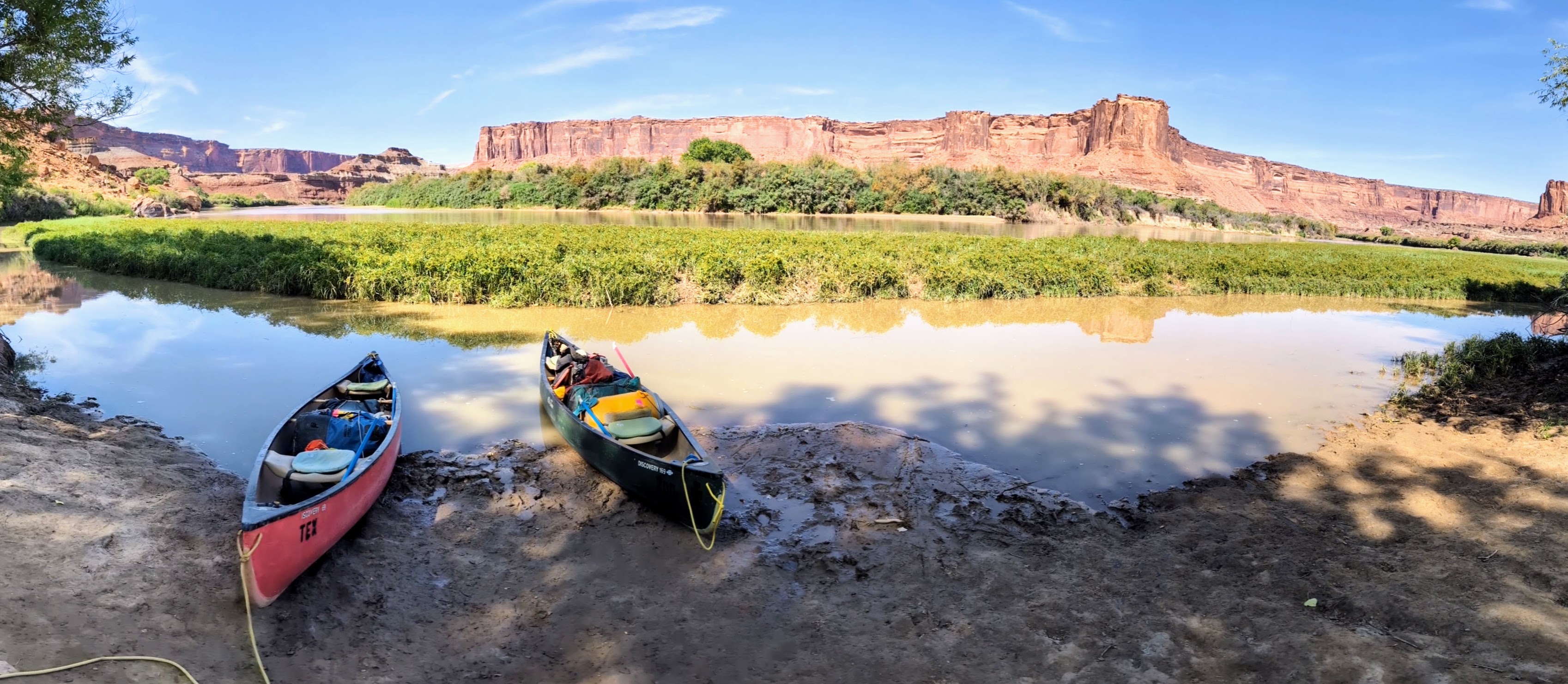
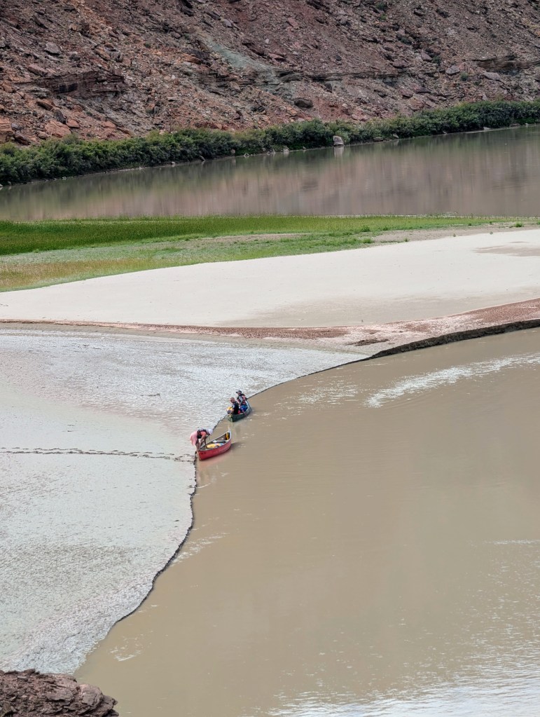
Up before dawn. Load the canoes, drift four hours on a lazy river through ever-deepening, colourful canyons. In the noonday sun, seek a sandbar where shade can be created. Secure the boats, assemble the lawn chairs, and roll out the sleeping bags. We love the rhythm of a multi-day canoe trip. This September trip – down a 100-mile section of the Green River in eastern Utah – is extra-special, because we are joined by our daughter and her husband.

Getting to the Green
“B as in Breathtaking,” announces the Alaska Airlines agent, as she calls our boarding group for the flight to Salt Lake City. She must know where we are going: to canoe the Green River’s Labyrinth and Stillwater Canyons, known for their breathtaking scenery.
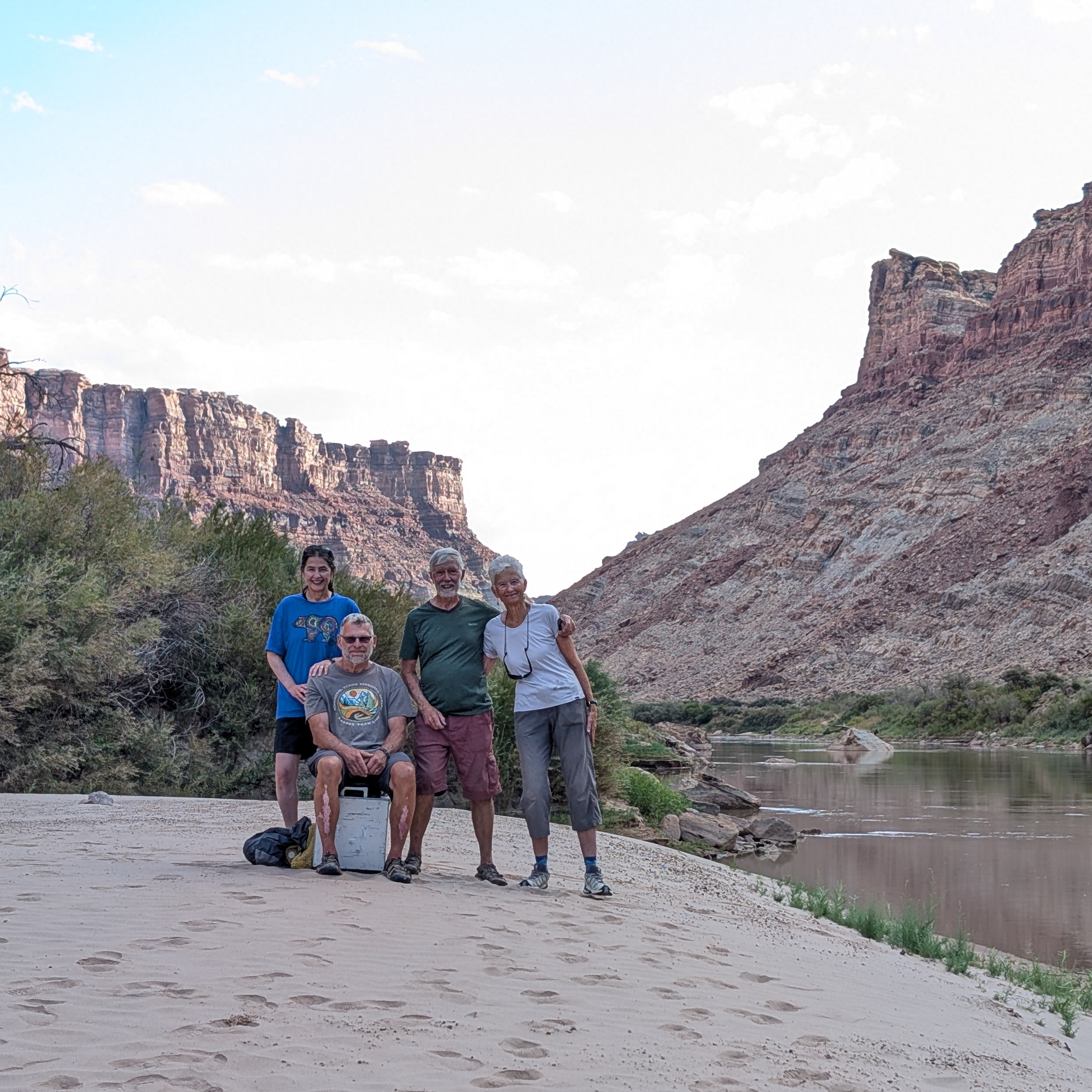
We, Doug and Cathy, canoed this route in August 2001, and it was life-changing. The Green River was so enchanting that we decided to retire the following year; full-time work was interfering with our canoe trips. With our daughter Kirsten and her husband Willy beginning to contemplate their own retirement, 2025 seems an appropriate time for a Green River encore.
In Salt Lake City Kirsten and Willy rent a Jeep Wrangler, which helps us blend in as we head to Moab, the outdoorsy gateway town that is a world-famous destination for off-road Jeeping.
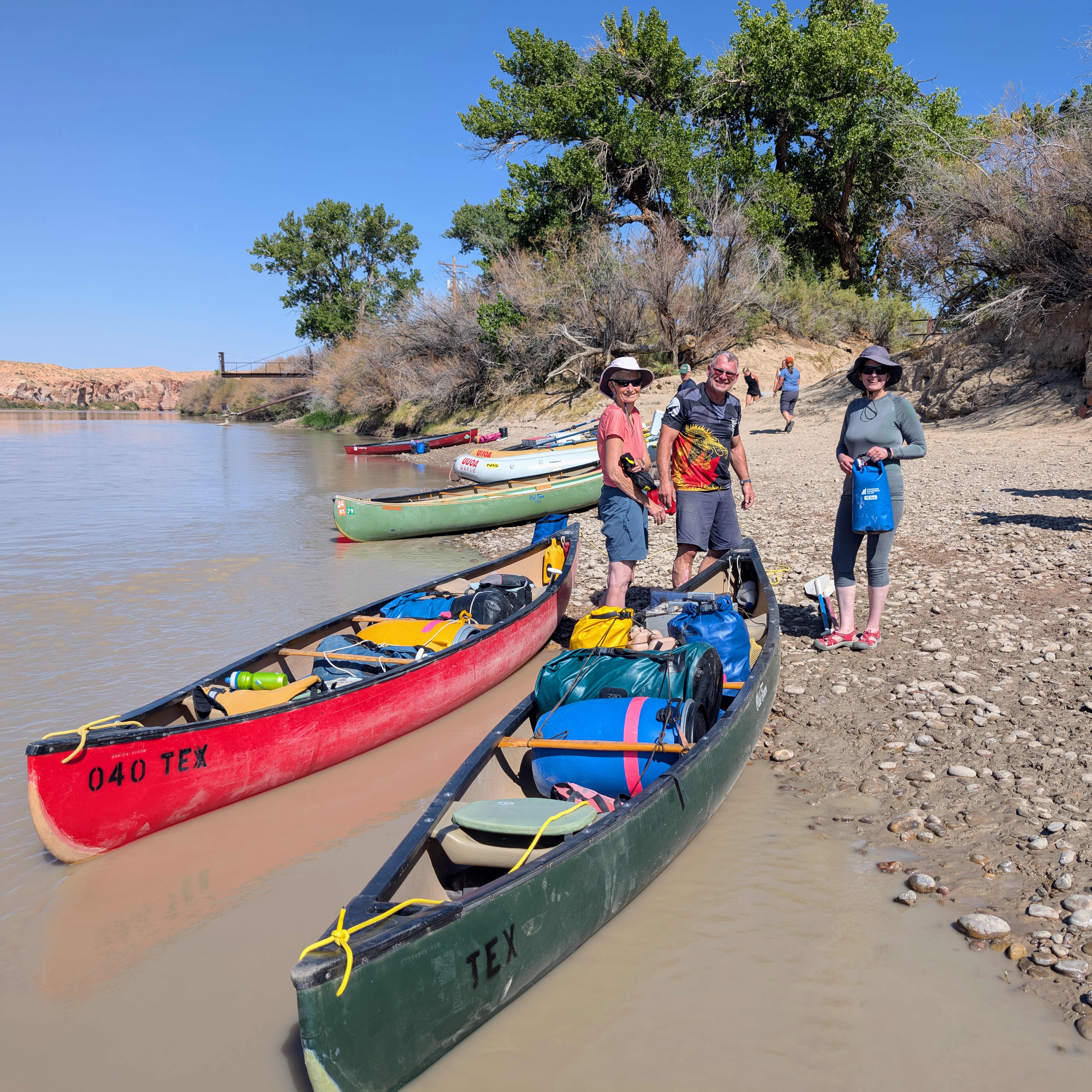
“You don’t have much gear,” says our Tex’s Riverways shuttle driver, as he surveys our mound of dry bags and our two food barrels. We aren’t worried. Our gear is well-tested, with some planned redundancies (e.g., four boat sponges, three methods of water purification, an extra quart of stove fuel, ropes and cords of various diameters) and 84 pounds of dried food (backpacking authorities say this amount, 1.75 lbs per person per day, is generous and should result in no weight loss).
We are told that five thousand people canoe this route each year, and September is the busiest month. We are one of five groups launching September 1, but Tex’s Riverways (in business since 1958) handles each group with military precision. Our shuttle driver shows us how the mandatory toilet works, points out some pronghorn antelope, and after a two-hour bumpy ride deposits us at our launch point, Ruby Ranch, River Mile 97.
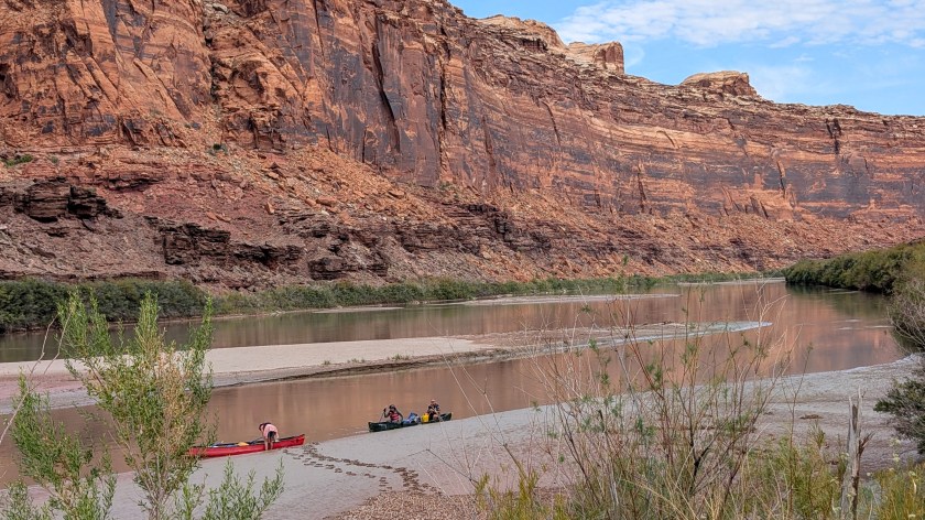
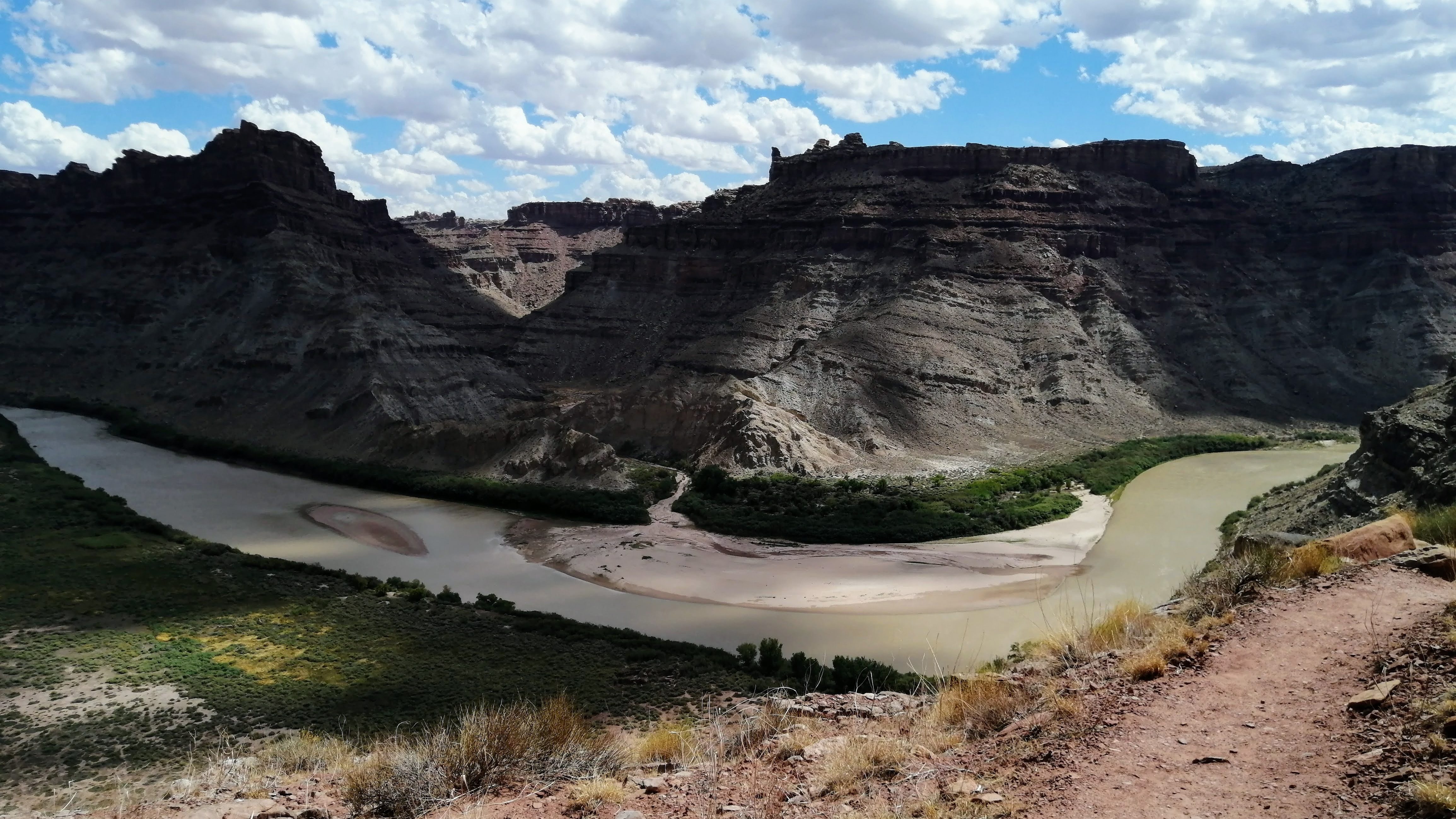
Wilderness of rock
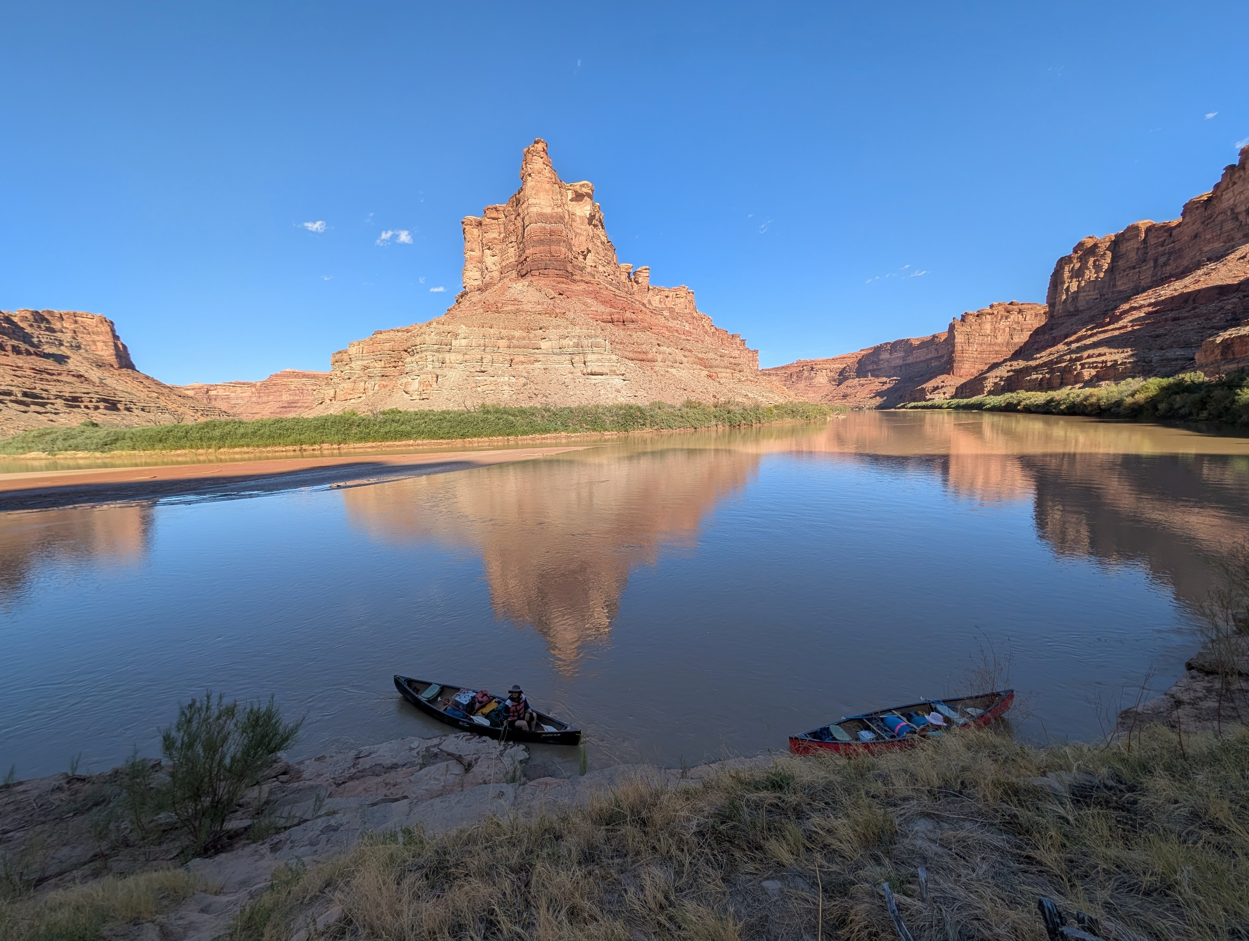
The Green River runs through Eastern Utah’s canyon country, where water has cut layers of rock into hundreds of canyons, mesas, buttes, arches, and spires. Canyon walls are 1,000 feet high or more, coloured red, yellow, orange, grey, white, and buff, often glazed with black desert varnish. For geologists, this must be paradise. For us, it’s simply grand, magical, jaw-dropping, stark, fragile scenery.
Oh, what mighty cliffs we know now! During our 2001 visit to Canyonlands National Park, Ranger Wayne gave us a way to remember the rock layers visible from the Green River: that’s Oh (Organ rock shale), What (White rim sandstone) Mighty (Moen Kopi formation) Cliffs (Chinle formation) We (Wingate sandstone) Know (Kayenta formation) Now (Navajo sandstone). Got it?
Labyrinth Canyon
First impressions: it’s quiet, and it’s hot.
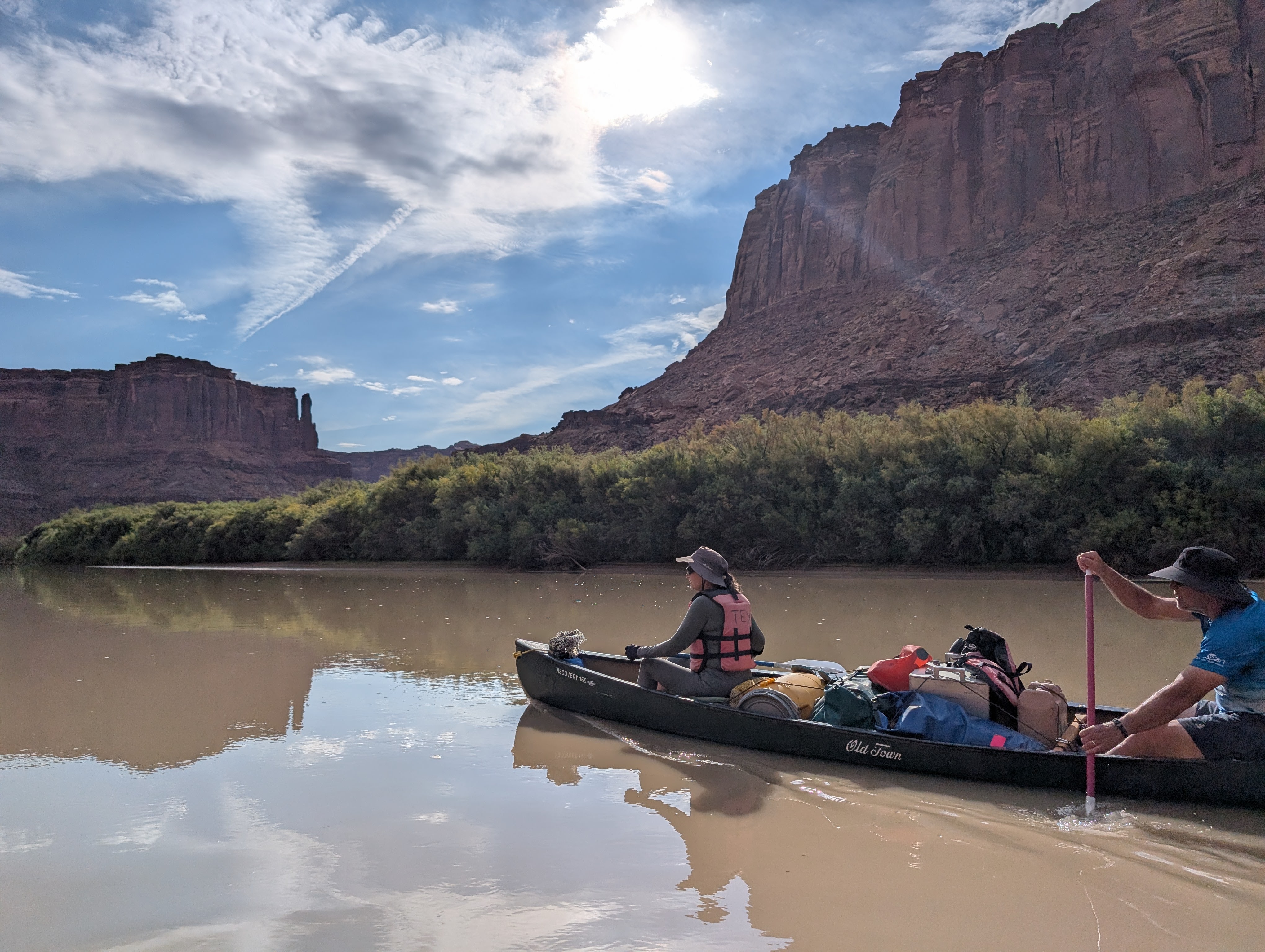
The mule deer move silently – or freeze – as we drift down the river. We humans chat or contemplate life until the silence is interrupted by the splash of a beaver, the fluttering of a Great Blue Heron, or the trill of a canyon wren.
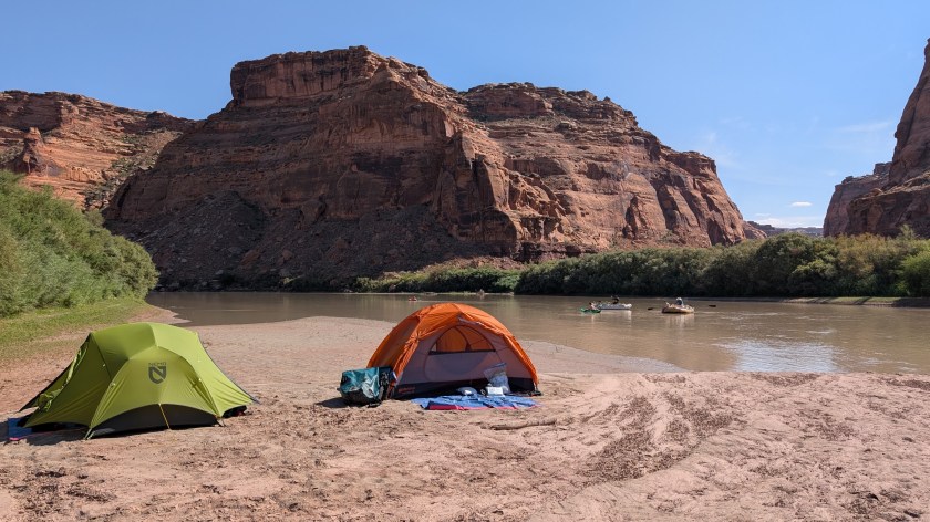
We don’t need a thermometer to register that it’s hot, above 90 degrees Fahrenheit – wilting temperature for us Vancouver Islanders. Our one perishable food item, a stick of butter, is fully melted by the time we reach our first camp, just past June Bottom. What is a Bottom? It’s low-lying land along a river.
We have chosen a leisurely pace for this trip, averaging just ten miles (16km) per day. Day two we encounter a four-canoe family from Ogden, Utah who have found an excellent swimming spot. Day three Doug bushwhacks in an unsuccessful search for the 1836 D. Julien inscription.
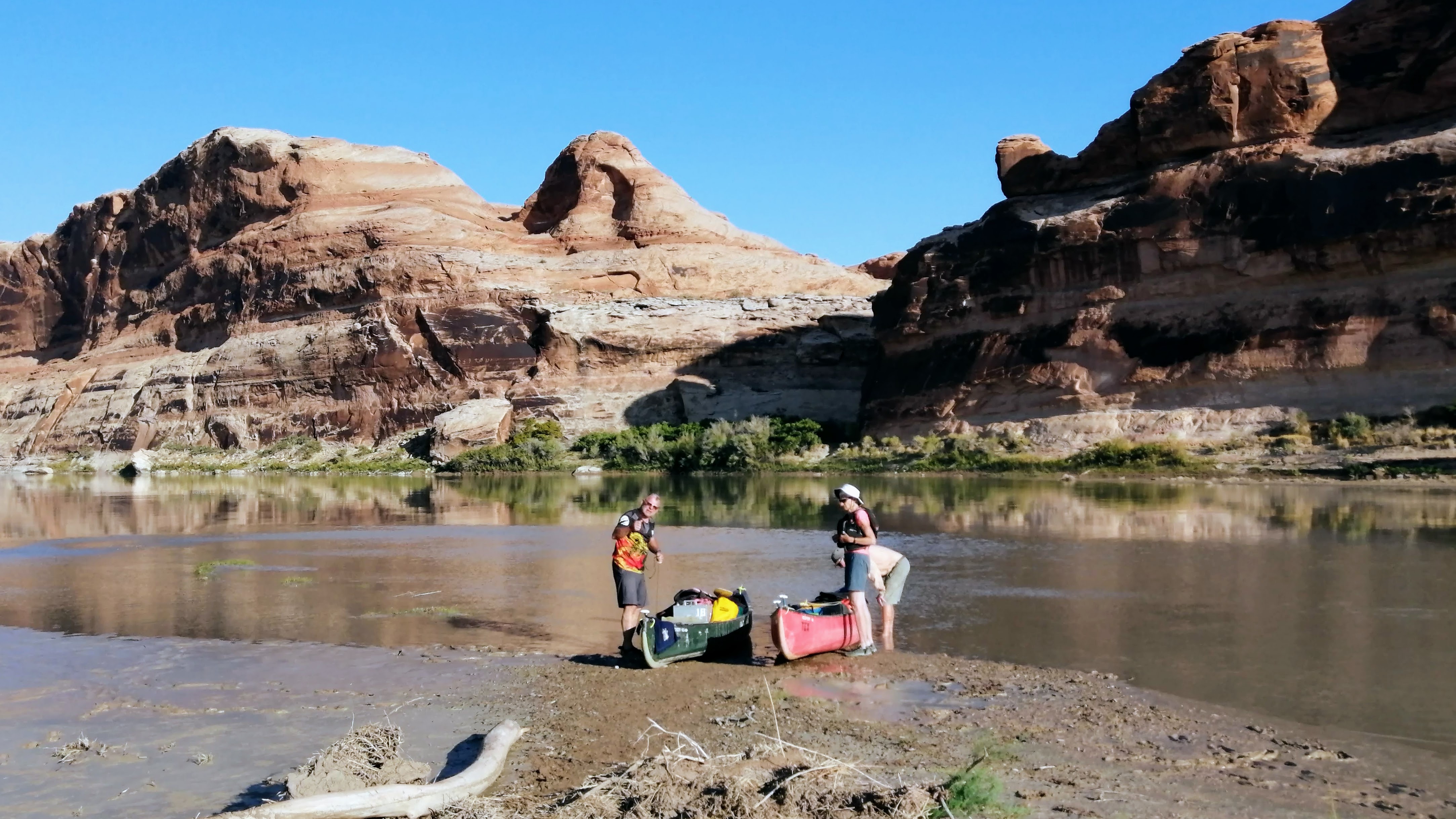
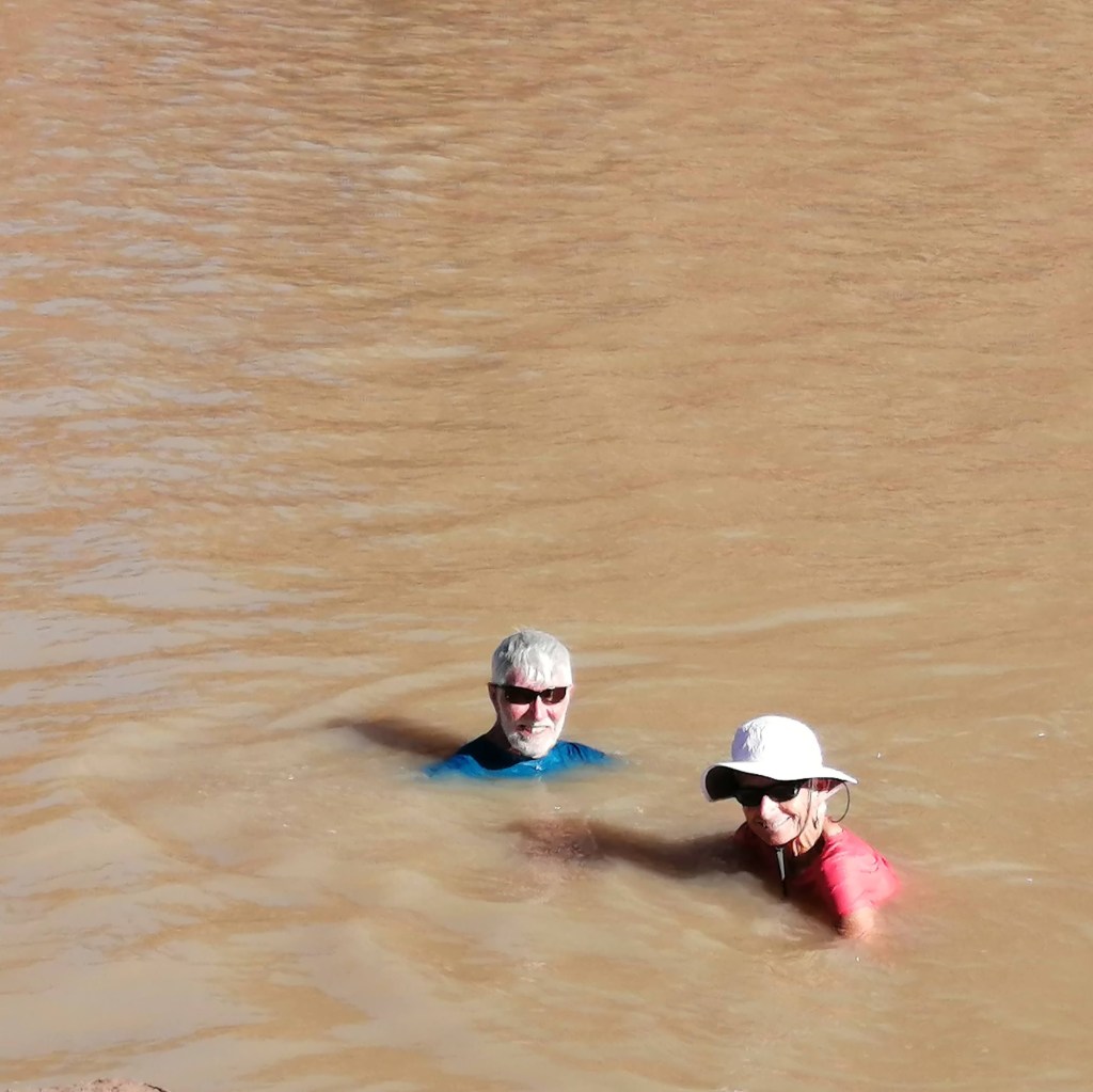
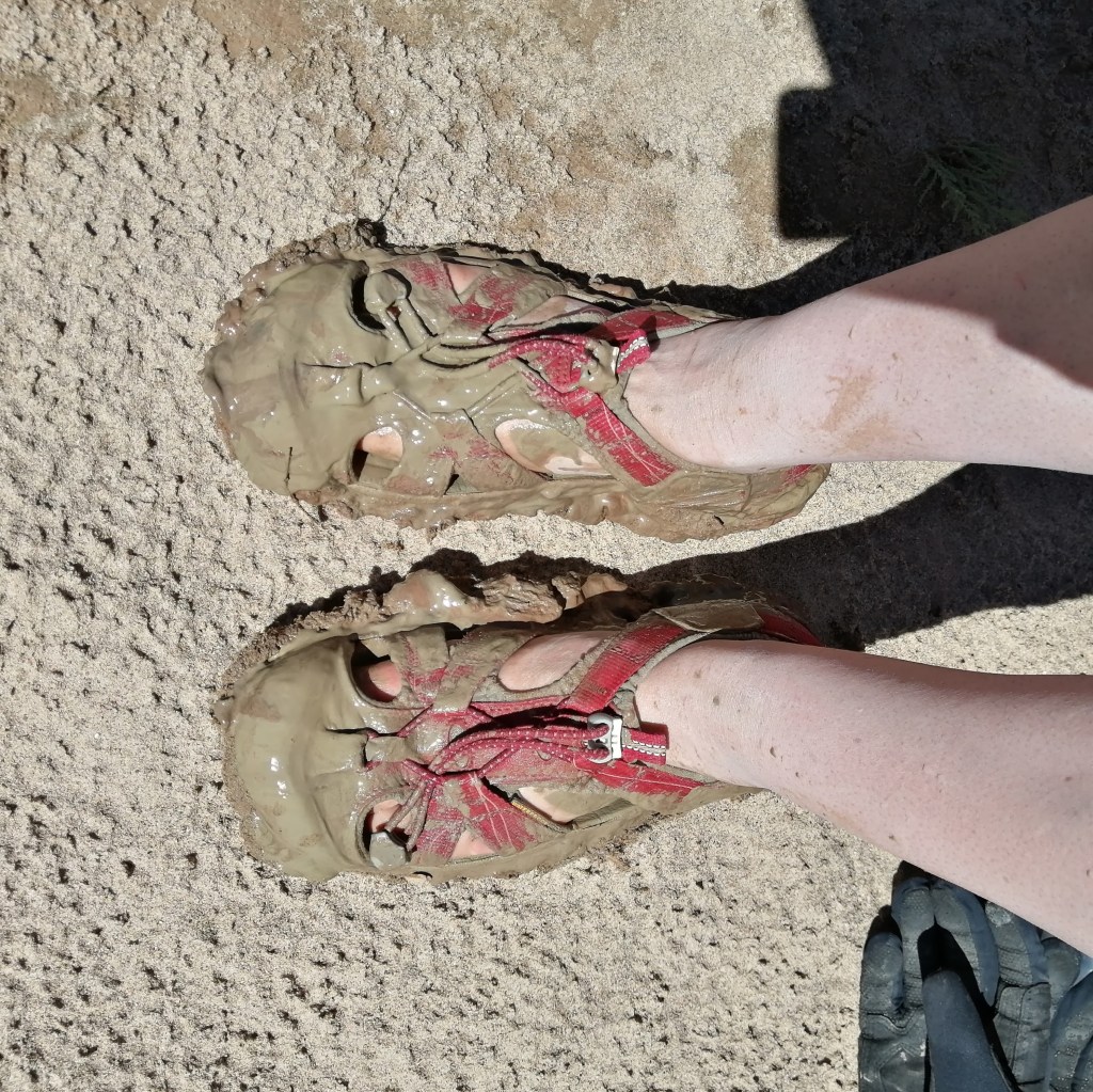
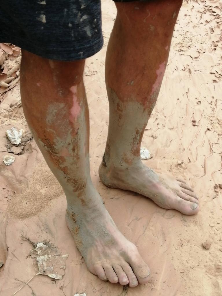
Willy investigates a high-water campsite, but it’s a steep, awkward climb, so we agree to specialize in sandbars. Mud-sand-camp, we’ve been warned by our shuttle driver, and he is correct: patches of white sand can only be reached by squishing through mud that sucks your water shoes right off your feet.
We go around the five-mile Bowknot Bend on day four, stopping for a swim and a chat with a solo paddler to whom we assign the trail-name Oregon. At abandoned meander Horseshoe Canyon we accomplish a little hike, which takes less time than the time to get ashore through the mud.
Mineral Bottom, the end of Labyrinth Canyon, is a launch and take-out point with a nice view, but the highlight is an outhouse – a break from our desert toilet routine (pee in the river, poo in the rental toilet box named Tex).
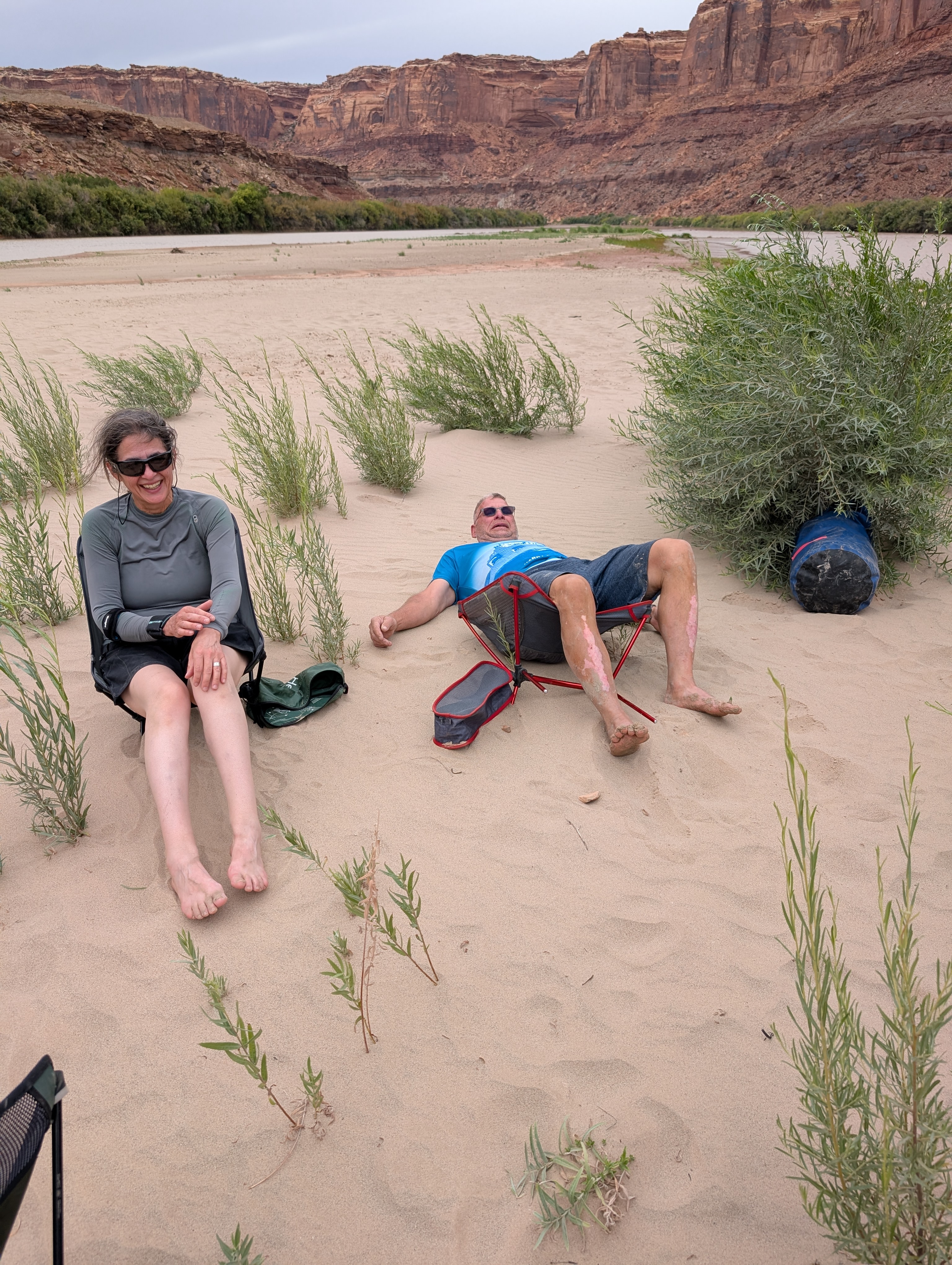
Eight o’clock is our bedtime, not to escape mosquitos (there aren’t any), but because we are ready. Being outdoors all day in the desert is hard work. Have we mentioned blowing sand? Sand is everywhere – in our teeth, our sleeping bags, our underwear.
Stillwater Canyon
Day five we enter Canyonlands National Park and camp within view of the Upheaval Dome crater. For now, Doug and Willy believe in the Meteorite Theory; later in the trip they decide that the Salt Dome Theory has merit.
At Beaver Bottom we hear distant thunder, and a few drops of rain fall. Out for a swim, Willy’s shorts escape and float down the river, never to be seen again. Days seven and eight we negotiate riffles (baby rapids) at Millard Canyon and Horse Canyon. On our final day in Stillwater Canyon, Doug and Willy climb a bank to water a newly-planted cottonwood tree, and Kirsten perfects her canyon wren imitation.
Down the Colorado
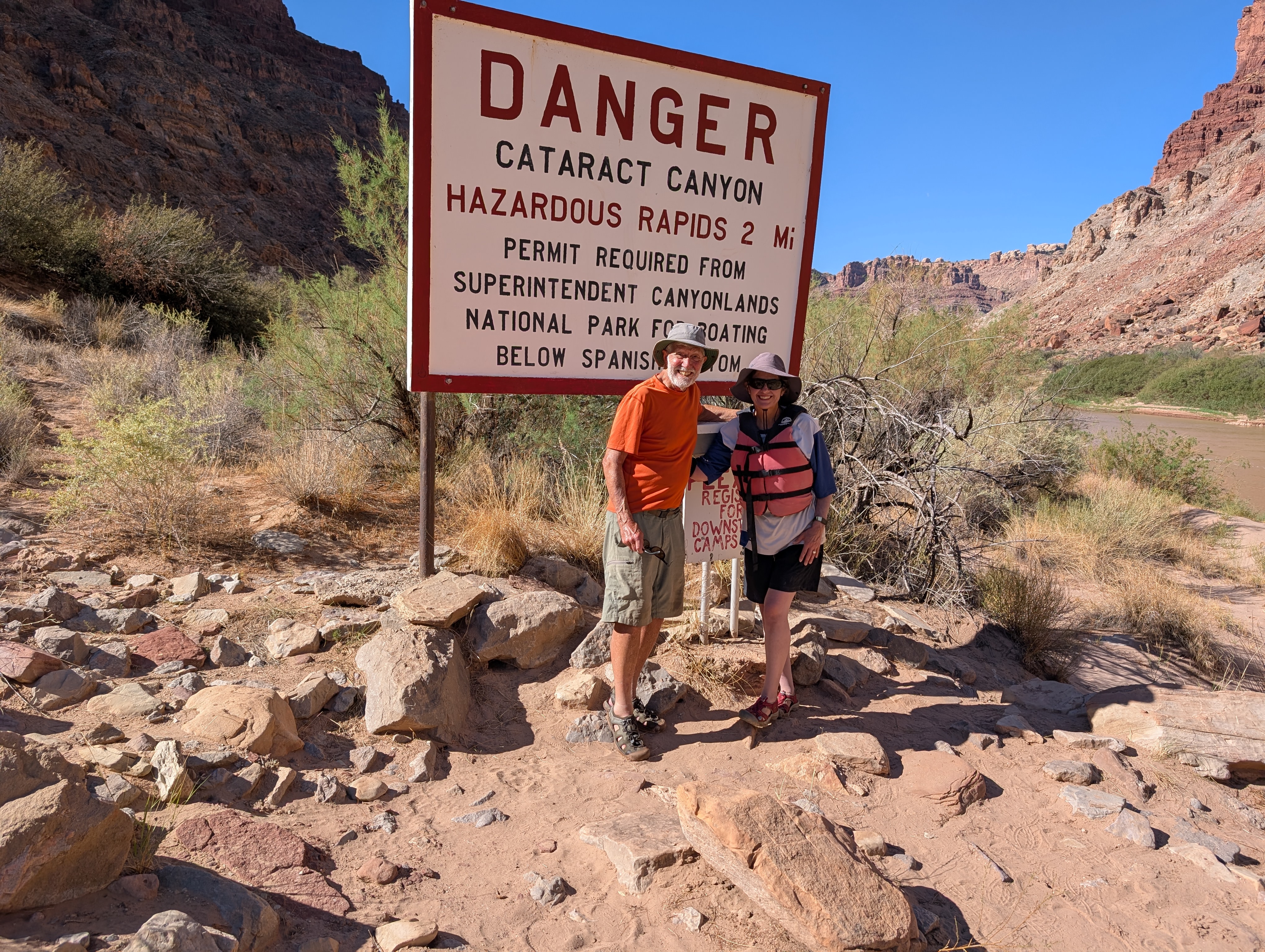
The Green and the Colorado unite at The Confluence, and four miles downriver the rapids (Class III-IV-V) of Cataract Canyon begin. We stop at the Danger sign and registration box, where paddlers are asked to register for campsites below the Confluence.
Upper Spanish Bottom is the only accessible site at this water level. Paddlers congregate here, but it is a spacious campground, and we have no trouble locating a wooded site that comes with a resident wild turkey named Doris. Doris is an aggressive, food-seeking bird, but she runs away when Kirsten waves a paddle threateningly.
To the Dollhouse
On Day 11 Kirsten and Willy put on their hiking shoes at 7:15am, aiming for a day at the Dollhouse, in the Land of Standing Rocks. From the Colorado River the trail to the Dollhouse climbs 1100 feet in one mile and takes less than one hour to ascend – once you locate the trail head.


Unfortunately, there is no signage or obvious trail between Upper Spanish Bottom and the trail head at Lower Spanish Bottom. Fellow campers say “go right”, which Willy takes literally, leading to three false starts over boulder fields and up steep canyons. The sun is brutal, but eventually they find the trail and make it to the top where it is flat and gorgeous, with colourful rock formations, prehistoric granaries, views down to the river, and five bighorn sheep (mothers and lambs).
When only one full water bottle remains, Kirsten and Willy head back down the trail to camp, where they drink several bottles of water and agree to take the rest of the day off.
Up the Colorado
Our gear is packed and assembled on the beach when the jetboat arrives at 9:30am on day twelve. Tex’s pick-up process is swift and choreographed, so in minutes we are aboard. We stop to collect a group of nine ex-Marines camped just below the confluence.
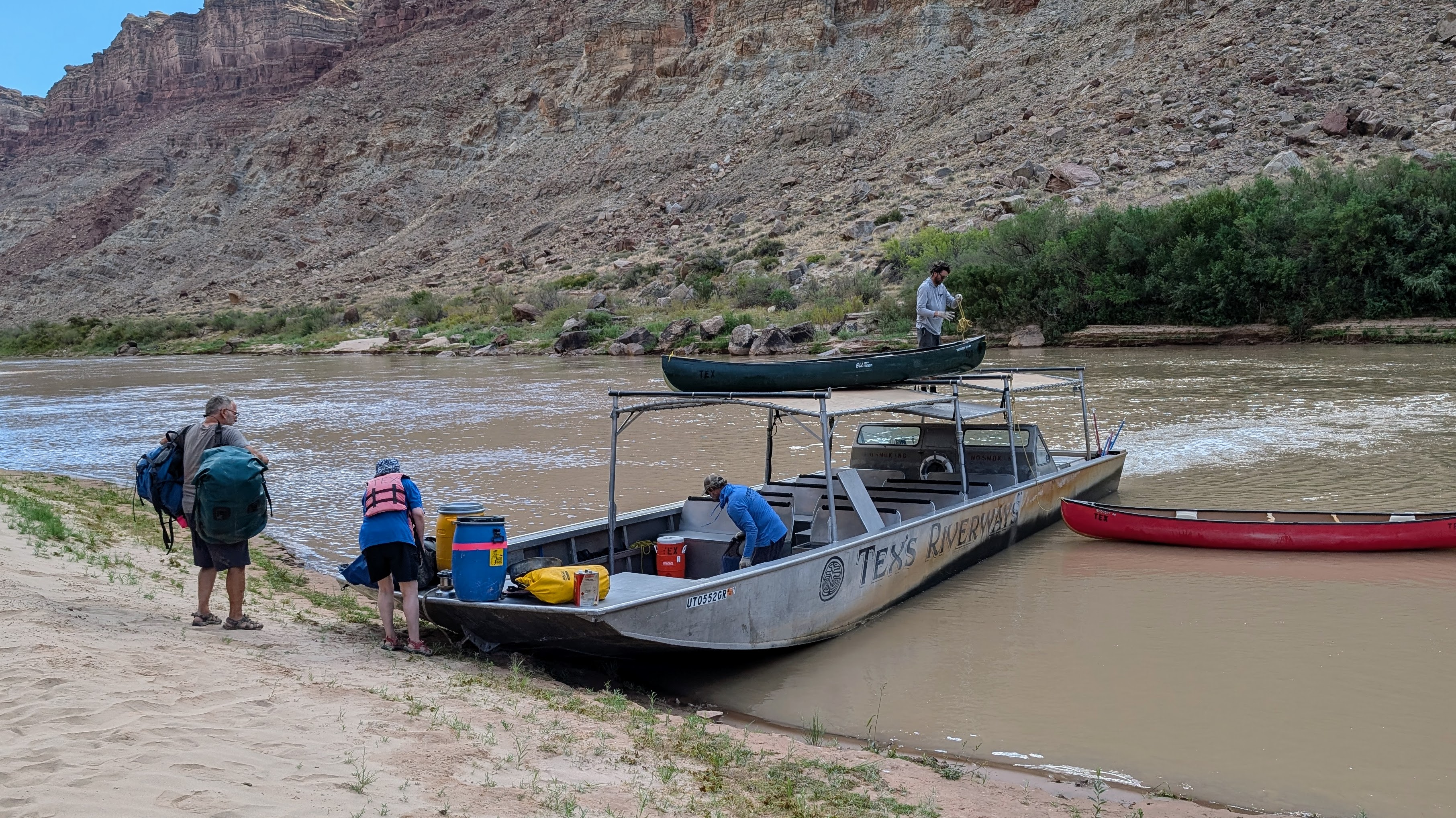
What driving skills! The jetboat zooms for two hours at 30mph, swerving to avoid sandbars and other obstacles. The scenery is awesome, but the speed and engine noise are a shock after twelve days of relative silence.
At Potash boat launch, just as we board a shuttle bus to Moab, our telephones (off-grid for twelve days) ping loudly with emergency alerts: flash flood warning, rainfall warning, thunder and lightning warnings. A large amount of water is suddenly dumped on the dry desert soil. We see waterfalls over canyon walls and red mud flowing down the road. Yikes! Aren’t we lucky this didn’t happen when we were on the river?
Tamarisk take-over

Upheaval Dome just below the full moon.
Tamarisk is now so dense that it blocks access to the river’s banks and side-canyons. Canyon hikes that we so enjoyed in 2001 are no longer possible.
Tamarisk, also known as salt cedar, was introduced for stream bank stabilization, but this aggressive bush has displaced native vegetation and altered wildlife habitat by consuming large amounts of water, lowering water tables, and increasing soil salinity.
Tamarisk removal, introduction of the tamarisk beetle (which eats tamarisk leaves), and planting of cottonwood trees are control and restoration efforts, but this is an uphill battle.
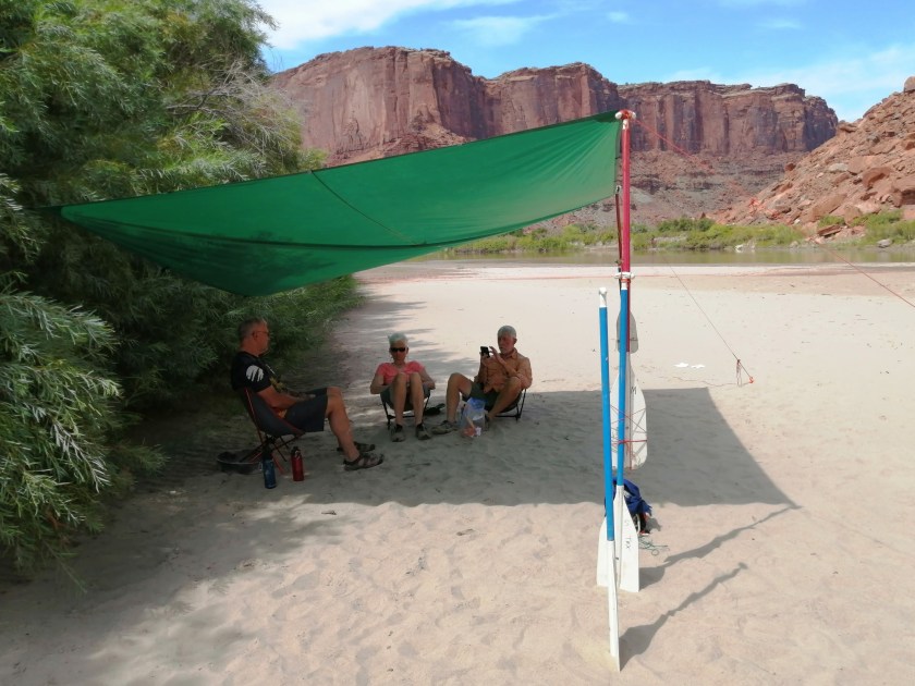
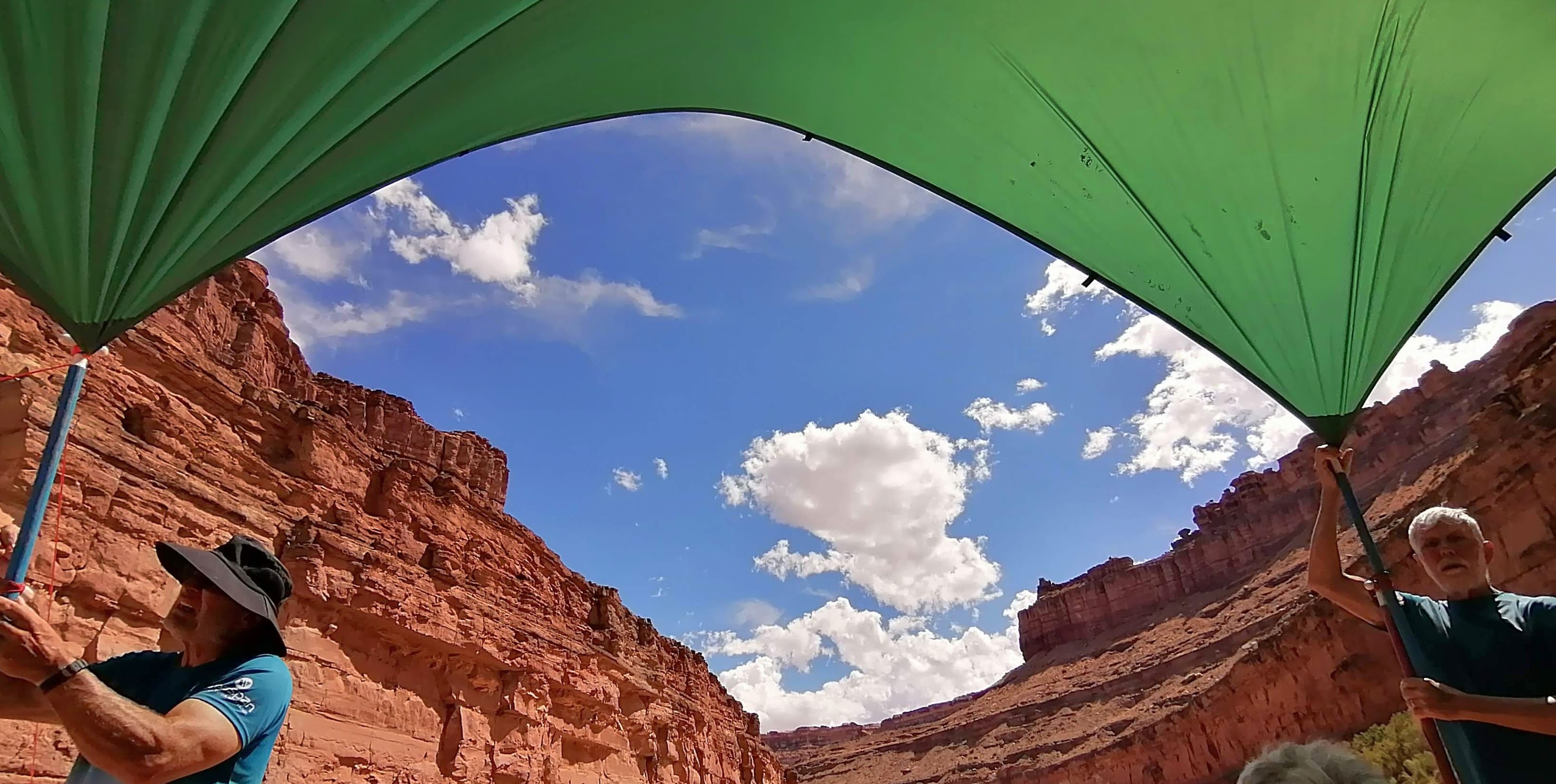
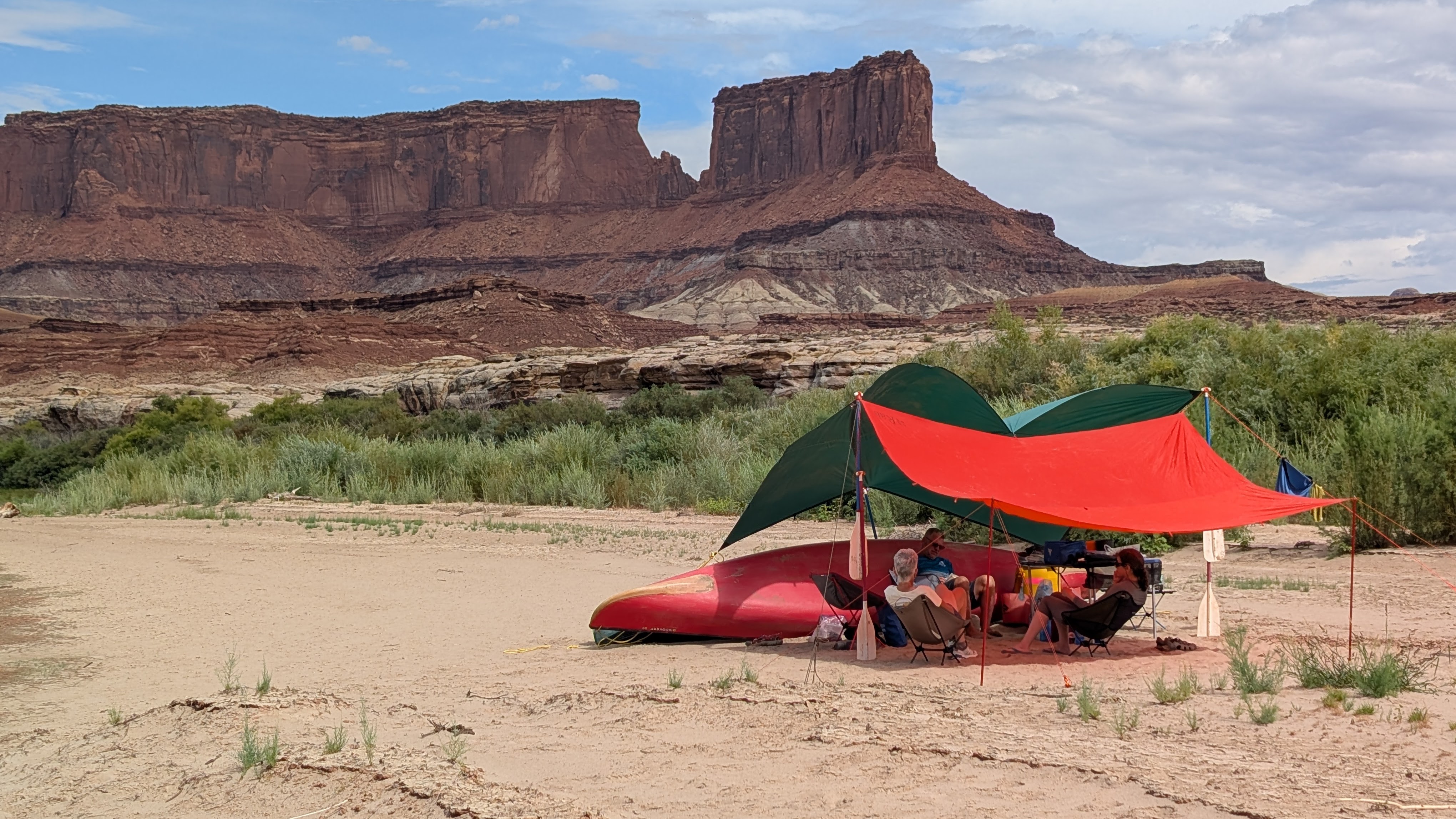
Tarp engineering and other skills
Teamwork and problem-solving: almost as much fun as paddling!
How to set a tarp on a windy, treeless desert sandbar? In our woodsy home province, tarping is a one-man job, but on the Green River it takes a team to calculate when and where the sun will set and to keep the tarp from blowing away. Willy is our team’s energetic, patient tarp master.
Another creative exercise is inventing uses for the fire pan. Campfire restrictions are in effect at the time of our trip, but we are issued a mandatory fire pan, to be used in case of hypothermia. Here are three uses we invent: (1) a stable base for a Helinox chair (to keep the chair’s slender feet from sinking into the sand), (2) a fire-proof support for the Dragonfly stove, (3) a foot bath, for washing muddy feet before crawling into the tent.
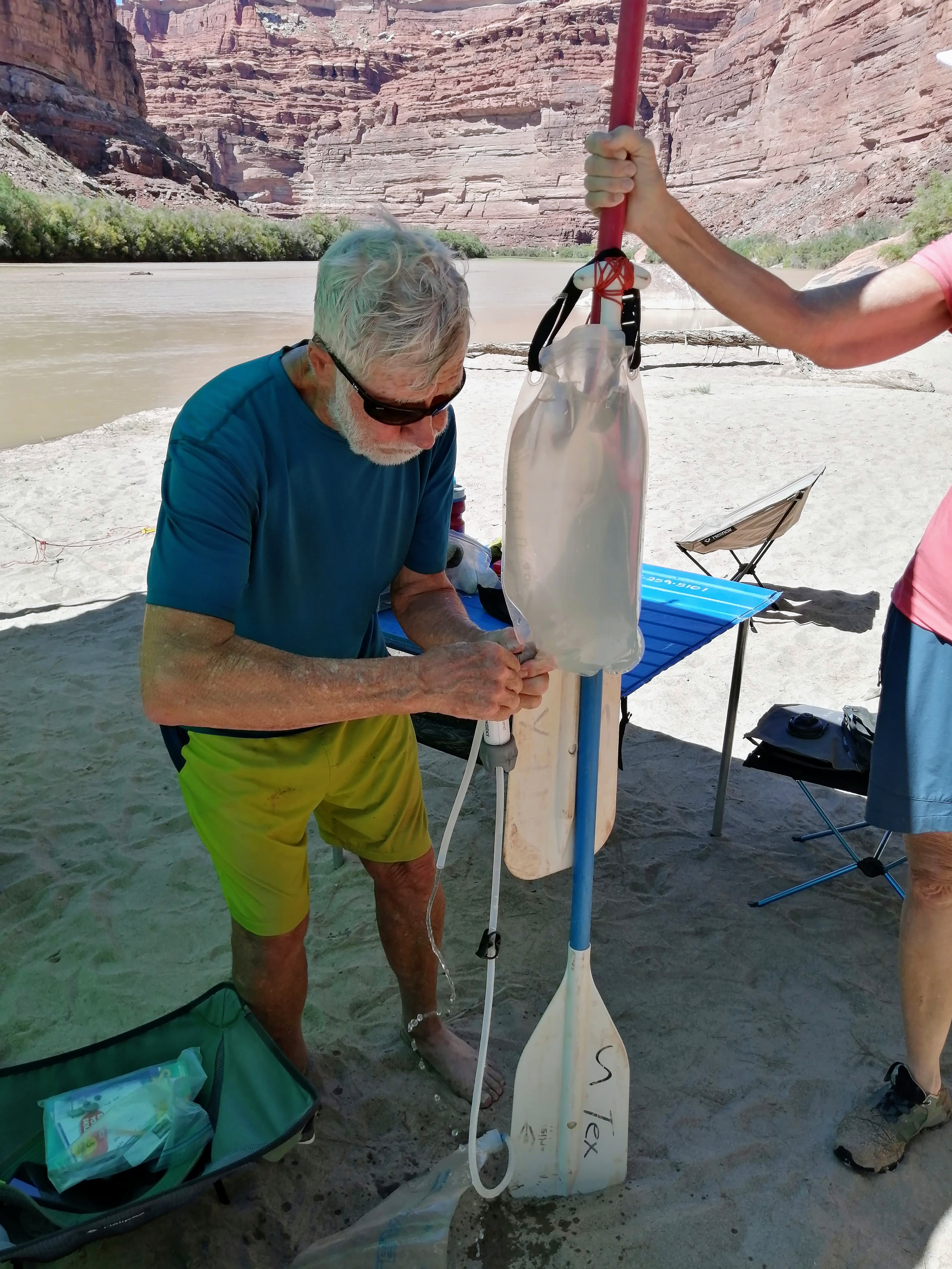
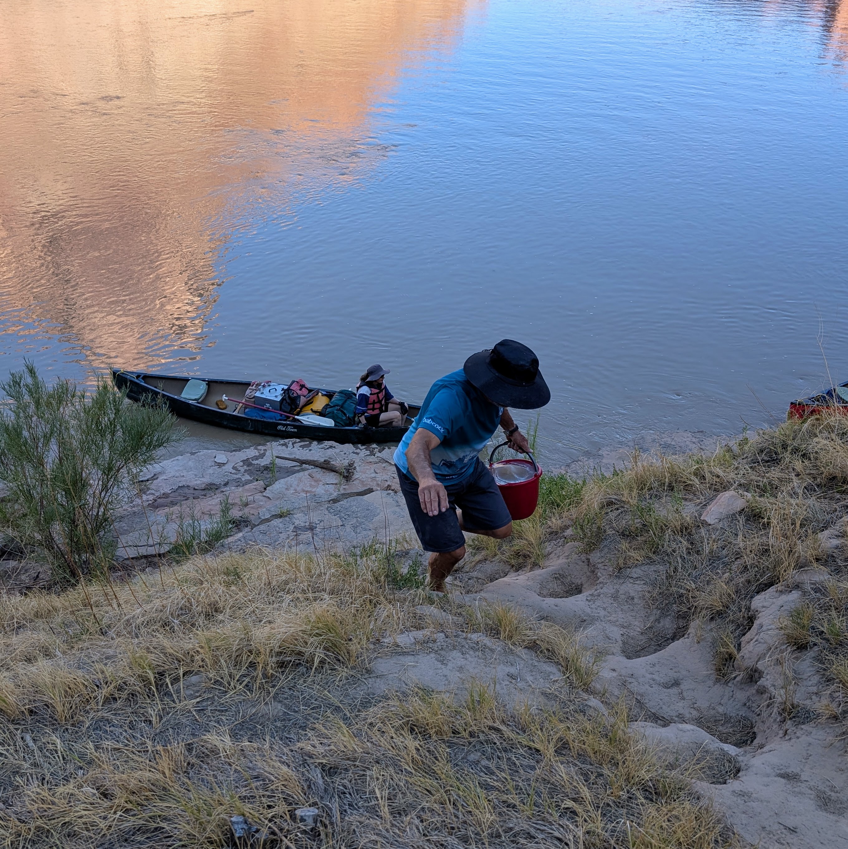
Purifying silty river water requires knowledge and skill. This is Doug’s area of expertise. He uses alum and tincture of time to settle the silt, then a gravity filter, backflushing as required. Kirsten is the apprentice water purifier, but only Willy can fetch and carry the 20-litre bucket full of river water.
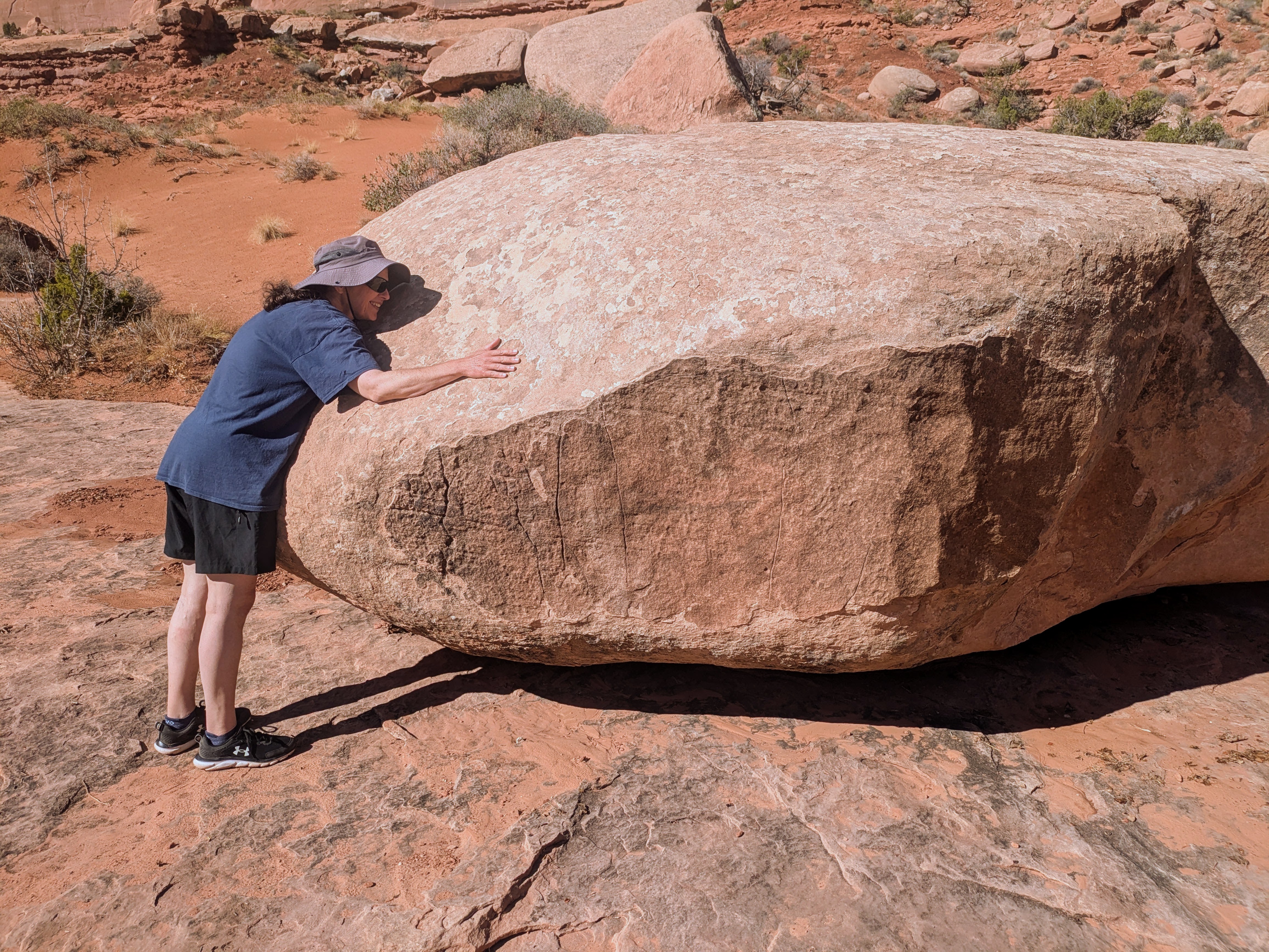
Arch appeal
Before and after the canoe trip, we visit the two national parks near Moab: Arches and Canyonlands.
Arches is a compact, busy park with two thousand natural stone arches, the largest collection in the world.
We tackle the Devils Garden Loop, a five-hour, hot hike that includes a scary rock edge where three of us want to turn around. Willy talks us down the edge, just one of many times he saves the day.

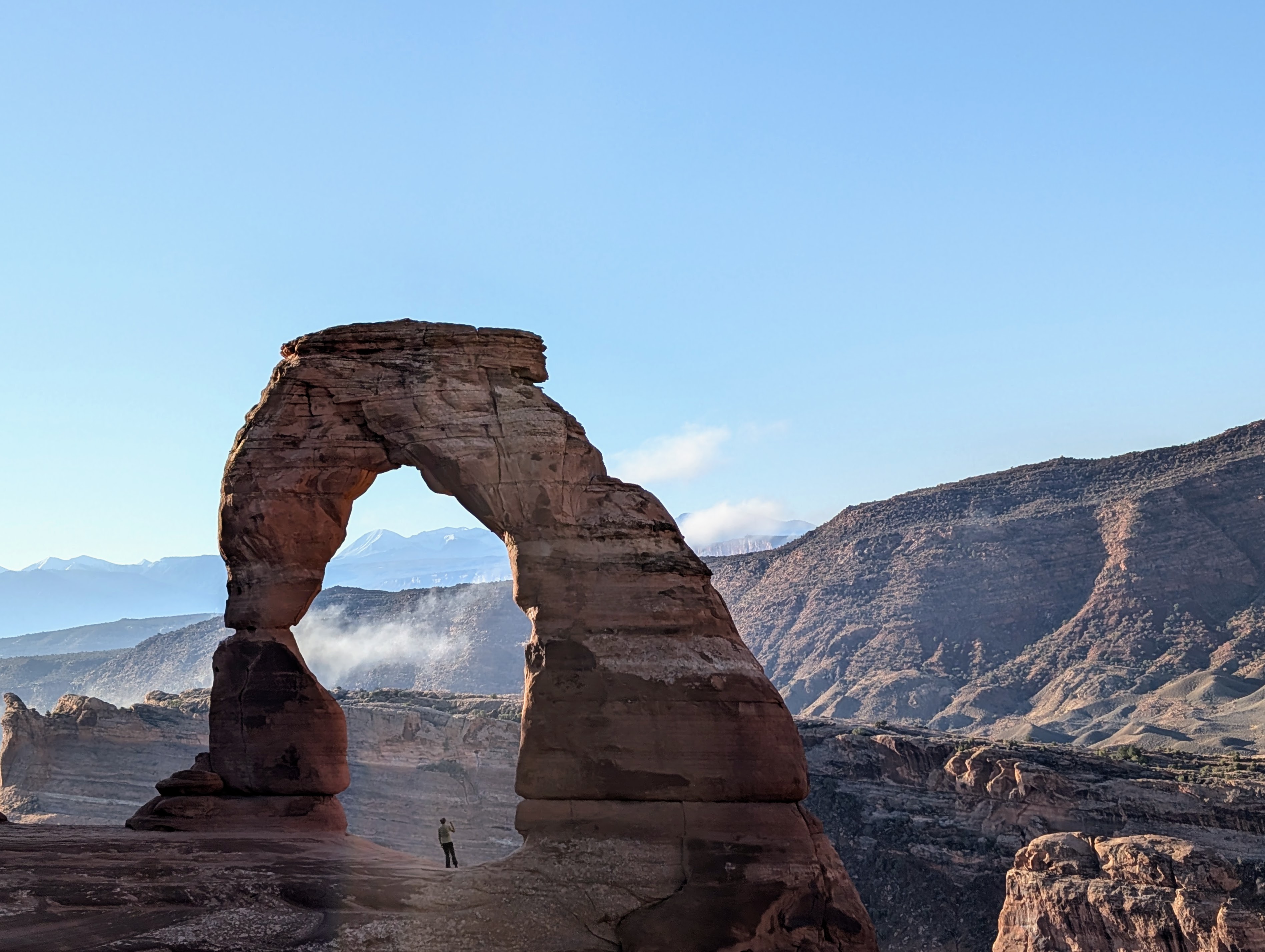
At Delicate Arch we join the procession of tourists who trek the trail (three miles, return) then queue to strike their cute Instagram poses in front of Utah’s most widely-recognized symbol. It’s a gong show, but we are part of it.
Canyonlands from the top
Arches is planned and managed well, considering the people-pressures, but it feels like a theme park compared to the sprawling Canyonlands National Park.
Mesa Arch is an easy walk to a dramatic view, but the highlight for us is seeing the Green River, the Confluence, Turk’s Head, and Upheaval Dome – from the top.
What would Edward Abbey say?
Edward Abbey warned of “industrial tourism” and planned development in Arches National Park, where he was a seasonal ranger in the summers of 1956 and 1957. Desert Solitaire, published in 1968, is standard reading for environmental activists.
Abbey proposed that cars be banned from national parks, so that visitors could experience the wilderness on foot, bicycle, or horseback.
Today, the national parks are truly car-focused, but Abbey would be pleased that the Green River remains a wilderness, where paddlers practice no-trace camping and enjoy an intimate relationship with the river.
Photo credits: Doug Hull, Kirsten Hull and Willy Burrows
If you go
Interested in canoe tripping on the Green River? Here are some links to start your research:
https://texsriverways.com/
https://www.nps.gov/cany/planyourvisit/flatwater.htm
https://bendingbranches.com/blogs/resources/canoe-tripping-on-the-green-river-in-utah
Anyone who can keep a canoe pointed downstream can handle this gentle, non-technical 100-mile stretch of river. At some water levels, riffles (baby rapids) occur at Miles 33.5 (Millard Canyon) and 14.5 (Horse Canyon); land upstream and scout them, if you are worried.
Backcountry camping and trip planning experience is recommended. After Ruby Ranch, Mineral Bottom is the only place with road access, and there is no cell phone service.
Bring your own paddle, if you are particular about paddle length, weight, and performance. Rental-grade canoe paddles are durable weapons, but they are a lot heavier than our carbon-fibre bent shafts.

Cathy and Doug, this is a delightful and informative report. It is, as we have come to expect of you, well organized, written and illustrated. I’m happy that you four had a good and meaningful trip. It brings back memories of our camping trips with two little ones that we so enjoyed when we lived in the Seattle area in the early 80s. Arches was one of the most memorable of those extraordinary National Parks.
LikeLike
Thanks for writing, Gillian. Arches is truly a family-friendly gem. Even with the crowds it seems a personal experience coming upon these geological creations.
LikeLike
Awesome! You guys simply ROCK!!!
Liz
LikeLike
Thanks, Liz. We’re happy to say no one ROCKed the boat or got hit by a ROCK tumbling down the canyon walls.
LikeLike
I totally agree with Gillian.
Another wonderful adventure from an amazing couple.
Thanks for sharing
LikeLike
Wonderful to travel with you by e-mail!
LikeLike
Thanks for writing, Dorothy.
LikeLike