
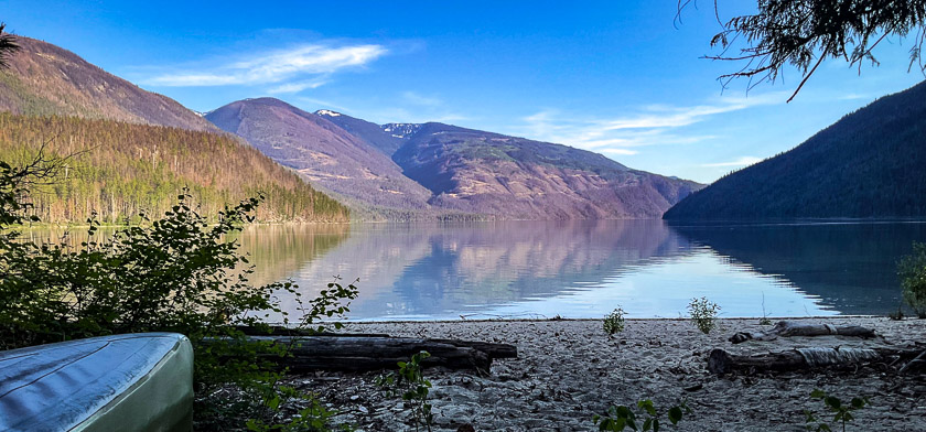
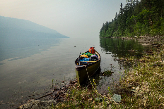
An interesting shape, Shuswap Lake, and it’s known as Houseboat Heaven. For two weeks we cruise the top half of the addled H in our boat of choice, a 17-foot canoe. Cycling the Okanagan Rail Trail, viewing peak water levels on the Adams River, and hiking the Joffre Lakes Trail are land-based activities before and after our Shuswap Lake canoe trip.
Somewhat bland but pleasing

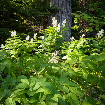
Somewhat bland but pleasing is how Lonely Planet describes the Shuswap region of British Columbia. That’s a fair assessment if you recall that the Latin word blandus means alluring, attractive, smooth, and gentle. Spotting eagles, listening to loons and the swish of the paddle, gliding past the occasional wildflower and unnamed waterfall, watching goslings learn to follow the leader, and counting butterflies: simple pleasures define our 15-day, 155-kilometre canoe trip.
Speaking of eagles, we observe one bald eagle facing a dilemma. He’s caught a huge fish, twice his size. The fish is too heavy for lift-off, but the eagle does not want to let go, because a raven is standing by waiting to snatch. The eagle will end up sharing, perhaps with a coyote, according to Jason (see Extra Thrills, below).
Houseboating Capital
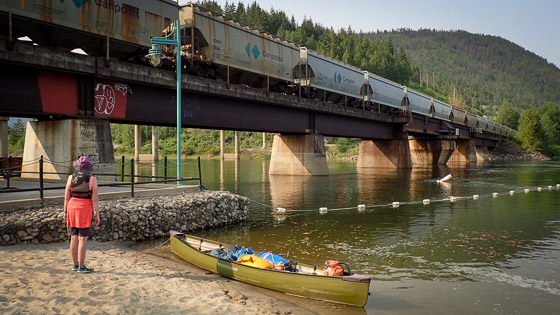
We launch our canoe in Sicamous, the Houseboating Capital of Canada. Thousands of visitors each year come to enjoy houseboats – floating cottages that can hold groups as big as twenty-eight. With its fleet of slow-moving houseboats and its high-speed motorized water toys, Shuswap Lake has a reputation as the place to party, but May is early season, and we hope to avoid the action.

“We had a canoe here once – or maybe it was a kayak,” says one of the three Park Operators we meet. Clearly Shuswap Lake is not yet a popular canoe-camping destination. On our last evening on the lake we spot a tandem canoe making the three-kilometre crossing we had completed the previous day. That canoe looks mighty tiny out there in the middle of the lake – and vulnerable, bouncing through the wake of a powerboat.
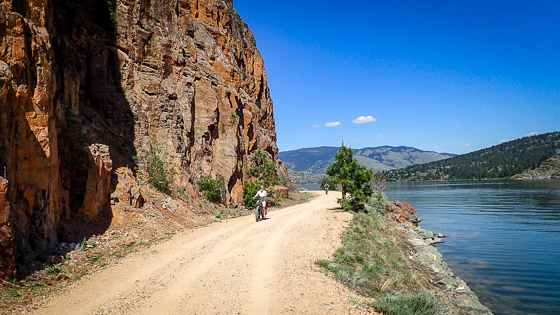
The top half of the H
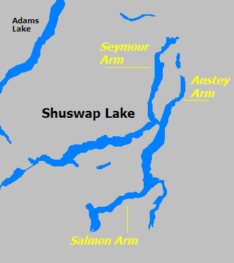
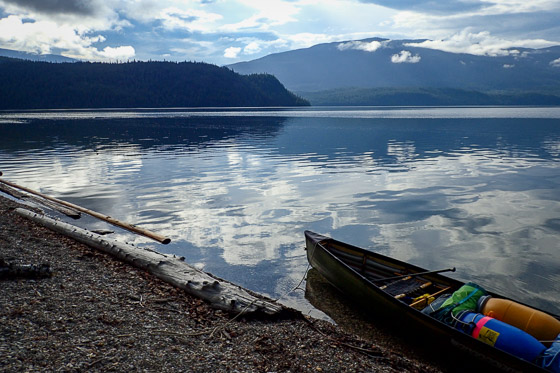
Shuswap Lake is a natural lake made up of four large, narrow arms, shaped like a lop-sided letter H and surrounded by forested hills. From Sicamous we cruise northeast up the Salmon Arm to Cinnemousun Narrows, the middle of the H, where the four arms converge. From the Narrows we head up Anstey Arm. Anstey is the shortest of the arms (18 km, centre-channel) and the least developed. Much of the land is within Anstey Hunakwa Provincial Park, which experienced major wildfire damage in 2021.

Next up is Seymour Arm, which is longer (30 km) and has some cottage developments. The town of Seymour Arm is an off-the-grid community that became a ghost town – twice. We walk a five-kilometre loop around the town, studying the substantial solar panel set-ups in front of each home. Daniel’s Floating Store and Marina is the go-to destination, and here we re-supply with a loaf of frozen bread and a blueberry crumble.
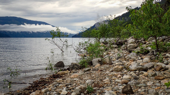
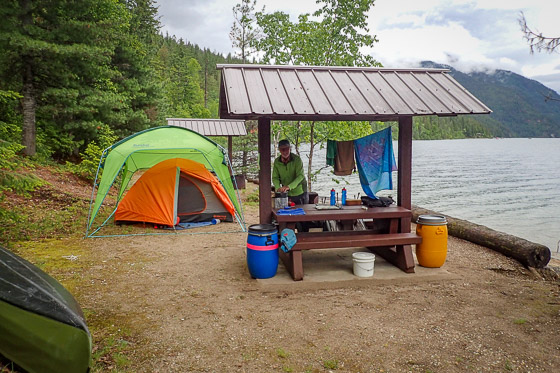
Shuswap Lake Marine Park has at least 23 sites located around the perimeter of the lake. Some sites have no facilities at all (wilderness camping is allowed), while others have a few tent sites, picnic tables with shades, a pit toilet or two, and a bear-proof metal box for food storage. Most of our fourteen nights we camp alone. On only two occasions do we have unpleasant encounters with houseboats: an all-night party at Encounter Point (a Twin Anchors Houseboat) and an all-day, full-volume blaring of rap and heavy metal music at Marble Point (a Sicamous Houseboat). If the music had been Big Band or jazz, we wouldn’t have minded so much.
Myth-buster: shoreline length
Tourism pamphlets claim that Shuswap Lake has “more than one thousand kilometres of shoreline to explore.” A Google search reveals reported shoreline lengths ranging from 405 to 1,430 kilometres.
Dan Goodale reported 622 km (386.5 miles) when he and his walking partner circumnavigated the four arms of the lake on foot in 1979 “to settle the long-disputed controversy over shoreline miles.” You can read Goodale’s adventures in his book, 27 days around Shuswap Lake: A true story, available from Amazon.

Using a GIS program, Doug calculates the shoreline length to be 324 km. We paddled 155 km and covered nearly half the lake, close to shore most of the time.
Who is right? Perhaps it doesn’t matter. The commonly-reported figure of one thousand kilometres has a nice ring to it, but to us, it seems too high to be true.
Sun, smoke, and squalls
Lonely Planet, take note. Shuswap weather is definitely not bland, at least during our first week on the water. We begin our cruise with an unseasonable, scorching, sweaty temperature of 35 degrees C; oh, so tempting to unzip those pfds. White-out conditions are next, as Alberta wildfire smoke spreads down the lake for two days.
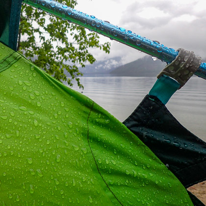
Now comes a day of squalls so strong that we are forced to make two emergency stops. The first time we cling to overhanging branches to keep from being blown backwards. The wind switches 180 degrees, and soon the following sea reaches the danger level. “You are welcome to stop here” and “the beach belongs to everyone” shout the cottage owners, as we surf-land on their patch of beach. We chat (we shout, actually, to be heard above the noise of the pounding surf) for half an hour, until the waves calm down enough to proceed.
“I wish it would rain,” sighs Doug, and boy, does his wish come true. Torrential rain causes us to shelter in our tent at Anstey View campsite for two entire days and nights. Cell phone service is surprisingly good on Shuswap Lake, so at least we know what weather to expect, and week two brings perfect paddling conditions.
A typical day
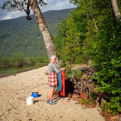
A typical paddling day looks like this: Wake at 5 o’clock, eat breakfast and pack up to be on the water by 7 o’clock (6:30 if mosquitoes nudge us along). Paddle for four hours or so (15-20 km), while the lake is calm and the power boaters are still sleeping. Make camp and take the rest of the day off. Some days we lay over, by choice (two days) or due to foul weather (two days). With such a leisurely paddling pace, how do we fill our fifteen days?
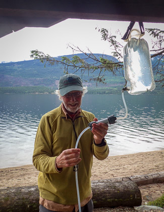
Does Doug’s Fitbit count paddle strokes as steps? We devise an experiment, but the results are inconclusive. Our first time-trial shows a large over-count of strokes when Doug paddles on the port side and an even larger under-count of starboard strokes. We plan further trials under different wave and wind conditions, but then the Fitbit breaks. No Fitbit, no problem. Doug finds another gadget: a phone app called Measure, which he uses to measure the height of our food barrels, the length of a picnic table, and the footprint of our tent.
We bring books to help us think about the world. Doug reads about money laundering (Freezing Order, Bill Browder), the oil industry (The Petroleum Papers, Geoff Dembicki), and espionage (A Spy Among Friends, Ben MacIntyre). Cathy reads about child poverty (Invisible Child, Andrea Elliott) and the transmission of knowledge (Knowing What We Know, Simon Winchester).
If you go
Red’s Rentals and Marina is a convenient and friendly place to store your vehicle if launching in Sicamous.
The BC Parks website, the Backroad Mapbooks topographic map, and Visitor Centre pamphlets provide sometimes contradictory information about whether campsites are open or closed, campsite amenities, and the location of Nine Mile Point on Seymour Arm. We found the Suncruiser Cruising Guide (at the Visitor Centre) to be the most up-to-date.
Depending on your route, some open water crossings may be required. Our longest crossing was three kilometres, thirty minutes of paddling. Easily managed in calm weather, but challenging otherwise.
The Shuswap Trail Alliance has produced a Paddle Guide in an effort to promote paddling as a “healthy, environmentally-friendly alternative to motorized recreation.” This is an admirable goal, but it will require a big change in lake culture. For now, paddle in the spring or fall to avoid heavy motorized traffic in the summer.
Before and After our Canoe Cruise
Extra thrills
At Tsutswecw (pronounced choo-chwek) Provincial Park we hike the Adams River Trail to the canyon gorge, hoping to watch rafts bouncing in the spring run-off, the “extra thrills” rafting season. Turns out the water is too fast and dangerous, so the rafts can’t run yet, but we find something even more interesting: a pit house and a new friend.
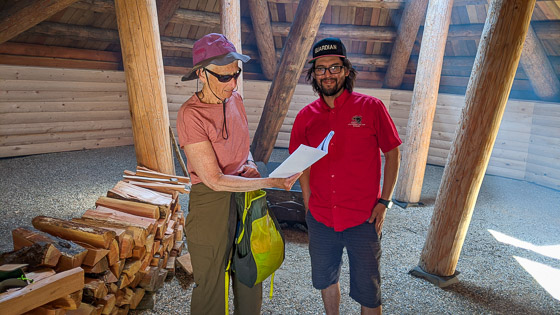
Jason, a Guardian from Little Shuswap Lake Band, welcomes us inside the fire-cooled pit house, which was just opened to the public in April. We learn about this traditional Secwepemc winter home, which is dug into the ground about a metre. A notched centre pole extends through a hole in the roof. Men climb up the pole to check for bears or enemies, down the pole to access the home. Women and children use a separate entrance, which typically faces the water and slopes from the ground into the pit below.
Thank you, Jason, for sharing information on a wide range of topics: pit houses, fishing tips, eagle behaviour, tadpoles, places to kayak in the Shuswap…
Teal, cyan, or indigo
Kalamalka Lake’s water is teal, cyan, or indigo depending on the time of year. In early May we can’t find an exact match on the colour chart, but whatever its colour, Kal Lake is a pretty little lake, situated between the city of Vernon and the small beach town of Oyama.
The Okanagan Rail Trail, a former CN Rail line converted to a multi-use pathway, runs along Kalamalka Lake. To check it out, we rent e-bikes from Kalavida Surf Shop, located at the Coldstream trailhead. A 57-kilometre ride takes us along Kal Lake to Oyama and back, with a side-trip to Pelmewash Parkway for a loop around Wood Lake and back to the ice cream store at Oyama Road.
How does the Okanagan Rail Trail compare to, say, the Lochside Trail in Greater Victoria? The Okanagan Rail Trail is more scenic because it runs along a lake the whole way. It’s easier to navigate, and it has more toilets. Headed to the Okanagan with your bike? You might like to check out our friend Colleen’s book, Okanagan and Beyond.
In sweltering temperatures we manage two ten-kilometre hikes near Vernon: Comin’ Round the Mountain Trail in Kalamalka Lake Provincial Park and a section of the Grey Canal Trail. Comin’ Round the Mountain is a loop with views of Kalamalka Lake and the surrounding hills. The Grey Canal trail is littered with remains (wooden trestles, cement foundations, galvanized troughs) of a system that supplied Vernon fruit farms and ranches with water between 1914 and 1970, when more modern methods of irrigation came into use.
Home stretch
We take a scenic route home, stopping the first at night at Green Lake Provincial Park. It’s summer-hot when we arrive, but we wake to ice pellets falling on the tent. From Green Lake we tackle the winding, mountainous Duffy Lake Road, which is either big fun (Doug) or frightening (Cathy).

In the olden days, before social media, the Joffre Lakes Trail was popular, but not crazy-busy. The old trail crossed a large boulder field, which limited access to the sure-footed or the slow-and-careful. Since our last visit, the trail has been re-routed and rebuilt, so that it is wide and well-groomed most of the way. After the trail improvements, day-hikers arrived in droves, posting photos on Instagram and leading to over-usage problems. In 2021 BC Parks initiated a free day-pass program to control the number of users. Snagging a day-pass and a parking spot are now the most challenging aspects of the Trail.
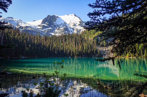
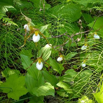
Arriving at seven o’clock on a Tuesday morning, we are the first on the trail. A half-dozen twenty-somethings pass us, but we are alone for most of the two hours it takes us to reach Upper Joffre, the third lake on the trail. We spend an hour admiring the lake’s striking colour, which is caused by glacial silt suspended in the water.

By the time we begin our descent, we face a conga line of hikers snaking their way up the trail. The hikers are multi-national, many with bear bells and selfie-sticks, and mostly young, although we do encounter one gentleman from Saskatoon who, like Doug, is 82. We enjoy providing encouragement to the many who ask “How much further?”

Another great adventure for you! Thanks for the story and beautiful photographs.
LikeLike